Severe Weather Outlook
Hayley here - Do you want to see severe weather in your calendar?
* it's like an add-on for your digital calendar NOT a paper calendar
National Severe Weather Outlook for the next week
Here you'll find all available severe weather outlooks on one page.
Overview of the threat for the next few days


Outlook for Thursday, August 27
Outlook Summary
Scattered strong to severe thunderstorms are possible across parts of the Northeast today. Damaging wind, hail and a tornado or two may accompany these storms. Large to very large hail and severe gusts are also possible across parts of western Nebraska and northwest Kansas.
Outlook Images
overview
tornado 2%

wind 15%

hail 15%

Detailed Outlook
← back to overviewSPC AC 270555
Day 1 Convective Outlook NWS Storm Prediction Center Norman OK 1255 AM CDT Thu Aug 27 2026
Valid 271200Z - 281200Z
THERE IS A SLIGHT RISK OF SEVERE THUNDERSTORMS ACROSS PARTS OF THE MID-ATLANTIC AND NORTHEAST…AND ALSO ACROSS PARTS OF WESTERN/CENTRAL NE INTO NORTHWEST KS
### SUMMARY
Scattered strong to severe thunderstorms are possible across parts of the Northeast today. Damaging wind, hail and a tornado or two may accompany these storms. Large to very large hail and severe gusts are also possible across parts of western Nebraska and northwest Kansas.
Mid-Atlantic/Northeast into parts of the central/southern Appalachians
An upper trough will remain in place over much of the eastern CONUS today. Moderate destabilization will be possible along/ahead of a weak surface trough/front extending from central NY/PA into the central/southern Appalachians. Scattered thunderstorm development is expected by mid/late afternoon, with sufficient deep-layer flow/shear for some storm organization (especially from the northern Mid-Atlantic into the Northeast). The strongest cells/clusters will be capable of producing scattered damaging winds and at least isolated hail. Modestly enlarged low-level hodographs may also support some brief-tornado potential. Some severe threat may persist into the evening before storms weaken and/or move offshore.
Father south, deep-layer flow/shear will be weaker into parts of the central/southern Appalachians, but scattered storm development within a relatively warm and well-mixed environment will support potential for localized strong/damaging gusts.
Central Plains
Moderate to locally strong destabilization is expected across parts of the central High Plains this afternoon, beneath modest northwesterly mid/upper-level flow. While large-scale ascent will generally remain rather modest, a subtle midlevel vorticity maximum may aid in isolated to widely scattered storm development from far southwest SD into western/central NE. Deep-layer shear will be sufficient for supercells, with steep lapse rates and relatively elongated hodographs supporting potential for large to very large hail, in addition to a threat for localized severe gusts. 00Z CAM guidance shows some uptick in storm coverage within this favorable environment, and a 15% hail area has been added for parts of west-central NE into northwest KS. Some guidance (notably the 00Z HRRR) also shows upscale growth and an attendant swath of severe-wind potential, though this scenario remains more uncertain. Greater wind probabilities may eventually be needed if confidence increases in the MCS scenario.
Surrounding the Level-2/Slight Risk, a more isolated threat of severe hail and wind may accompany the strongest cells from parts of the Raton Mesa and CO Front Range vicinity into eastern WY.
Western/central Montana
Despite rather limited low-level moisture, widely scattered storm development is expected this afternoon across parts of western/central MT, aided by strong heating and the influence of a midlevel shortwave trough and jet maximum that are forecast to crest the amplified upper ridge that is covering much of the interior West. Steep lapse rates will support potential for localized downbursts and strong to severe outflow gusts as storms spread east-northeastward across MT.
Northeast NV/northwest UT/southeast ID
High-based storm development is also expected from parts of northeast NV into northwest UT and southeast ID. While deep-layer flow and storm organization will likely be somewhat weaker compared to areas farther north, steep lapse rates and large DCAPE will support potential for strong to severe outflow gusts from this afternoon into the early evening.
South-central TX into the LA Gulf Coast region
Uncertainty remains regarding how far south an ongoing storm cluster and its attendant outflow will move across parts of LA/MS early this morning. If this cluster persists to the beginning of the forecast period (as forecast by the 00Z HRRR), then a localized wind-damage threat will be possible near the immediate LA/MS Gulf Coast before storms move offshore. If the cluster weakens and more substantial recovery and diurnal destabilization occurs later today (as forecast by more recent HRRR runs and some other HREF members), then storm redevelopment will be possible by afternoon, potentially aided by a remnant MCV. This scenario could also result in a localized wind-damage threat.
Farther west, scattered storm development is forecast across south-central TX this afternoon, near a weak southward-moving cold front. Deep-layer shear will likely remain quite weak, but moderate buoyancy, large PW, and steep low-level lapse rates will support potential for localized downbursts. Despite the weak shear, the northerly flow regime may result in one or more outflow-driven clusters that will move southward into the early evening before weakening.
..Dean/Weinman.. 08/27/2026
CLICK TO GET WUUS01 PTSDY1 PRODUCT
NOTE: THE NEXT DAY 1 OUTLOOK IS SCHEDULED BY 1300Z
Outlook for Friday, August 28
Outlook Summary
Isolated strong to severe storms are possible across northern Georgia into the Carolinas and Virginia and the northern/central Plains.
Outlook Images
overview
tornado low

wind 5%

hail 5%

Detailed Outlook
← back to overviewSPC AC 270559
Day 2 Convective Outlook NWS Storm Prediction Center Norman OK 1259 AM CDT Thu Aug 27 2026
Valid 281200Z - 291200Z
THERE IS A MARGINAL RISK OF SEVERE THUNDERSTORMS FOR NORTH GEORGIA INTO THE CAROLINAS AND VIRGINIA AND PORTIONS OF THE NORTHERN/CENTRAL PLAINS.
### SUMMARY
Isolated strong to severe storms are possible across northern Georgia into the Carolinas and Virginia and the northern/central Plains.
North Georgia to the Carolinas
Moderate to potentially strong instability is forecast to develop south of a stalled cold front from the southern Appalachians to the Mid-Atlantic where upper 60s to low 70s dewpoints will be present. Lapse rates will be quite weak (~6 C/km), but most guidance shows temperatures warming into the low to mid 80s which should provide pockets of moderate to strong instability. Effective shear is forecast to be weak (15 to 20 knots), but only slight modifications in the effective layer calculation result in significantly greater effective shear (30 to 35 knots) given moderate to strong flow above 7km. Therefore, any storms that can take advantage of this stronger flow aloft may be longer-lived and capable of some damaging wind gusts.
Central/Northern Nebraska into central and eastern South Dakota and Vicinity
A mid-level ridge will slowly deamplify through the day on Friday across the northern Plains. As this occurs, lee troughing will strengthen through the day with a lee cyclone forecast to develop across western South Dakota by early Saturday morning. Strengthening southeasterly flow ahead of the lee trough will advect low to potentially mid 60s dewpoints into South Dakota. This will result in moderate to potentially strong instability in the region. However, most forecast soundings show the environment remaining capped for much of the day which casts some doubt on diurnal storm coverage. Some 00Z CAM guidance shows storms prior to 00Z across western portions of the Marginal Risk area, but without strong forcing, it is unclear if these storms will develop. Given the capped airmass, the primary storm focus will likely be across northeast Nebraska and eastern South Dakota, at the nose of the low-level jet where warm-air advection will strengthen in the evening. Forecast soundings show moderate to strong instability and strong shear within this zone after 00Z. Large hail may be the primary threat in the evening with the wind threat more dependent on potential upscale growth.
..Bentley.. 08/27/2026
CLICK TO GET WUUS02 PTSDY2 PRODUCT
NOTE: THE NEXT DAY 2 OUTLOOK IS SCHEDULED BY 1730Z
Outlook for Saturday, August 29
Outlook Images
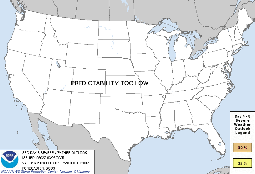
any severe predictability too low
Note on Medium Range Outlooks
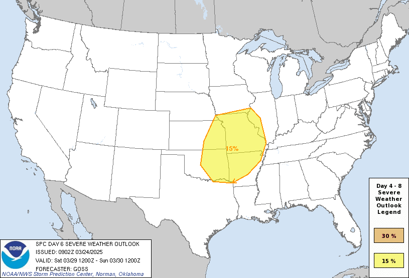
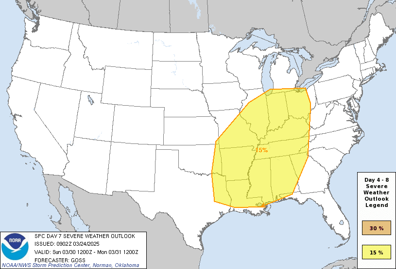
You are looking at an outlook that is part of the medium range forecast (the outlook for days 4-8). The most important thing to note is that lack of a risk does not mean zero risk. Generally speaking, confidence has to be pretty high for the Storm Prediction Center to have an outlook area this far into the future.
When no specific risk areas are shown, you might see one of these phrases:
- Predictability Too Low: This means that severe storms might be possible, but forecasters aren't confident enough about where or when they might occur. Think of it as the models showing different possibilities, like pieces of a puzzle that haven't come together yet.
- Potential Too Low: This means forecasters are fairly confident that widespread severe weather is NOT expected on that day. While isolated storms might still occur, the chance of reaching severe criteria across any given area is very low.
If you bookmark this page, it will continue to update with each new outlook that is issued.
Days Covered in this Outlook
| Day 4 | Saturday, August 29 | predictability too low |
| Day 5 | Sunday, August 30 | predictability too low |
| Day 6 | Monday, August 31 | predictability too low |
| Day 7 | Tuesday, September 1 | predictability too low |
| Day 8 | Wednesday, September 2 | predictability too low |
Detailed Outlook
← back to overviewZCZC SPCSWOD48 ALL ACUS48 KWNS 260842 SPC AC 260842
Day 4-8 Convective Outlook NWS Storm Prediction Center Norman OK 0342 AM CDT Wed Aug 26 2026
Valid 291200Z - 031200Z
DISCUSSION
D4/Saturday - Northern Plains to Upper Midwest
A mid-level ridge will move slowly east across the Plains with slight suppression through the day. A lee trough will consolidate into a surface low across the northern Plains through the day Saturday. Ahead of this surface low, strong instability is forecast across South Dakota and vicinity. Despite the favorable environment across this region, primary forcing will be focused on the nose of the low-level jet across Iowa and into Wisconsin, well east of the greatest instability and near the Canadian border. Therefore, limited storm coverage precludes severe weather probabilities at this time, but given the favorable environment, it will need to be monitored closely.
D5/Sunday - North Dakota and Vicinity
A mid-level shortwave trough will move from the Pacific Northwest to the northern Plains Saturday/D4 and Sunday/D5. 00Z guidance has come into fairly consistent agreement with the location and amplitude of this trough across eastern Montana at 00Z Sunday evening. However, there is considerable disagreement with the degree of destabilization across North Dakota, where forcing will be greatest. The GFS dry bias across most of the Plains has severely lessened the instability. However, despite this challenge, it is apparent that most of the instability significantly southeast of the upper-level forcing. The GFS-Para seems to have a more realistic handle on low-level moisture/instability magnitude but it also shows a significant disconnect between where this instability is located and the deeper forcing.
The deterministic ECMWF forecast shows a potentially significant severe weather event across North Dakota with strong instability and shear ahead of a robust convective QPF signal. This is supported by the AI-ECMWF which shows a similar evolution. However, the EC-ensemble mean of instability shows at least some trend toward the GEFS with primary instability southeast of the best forcing.
It is also worth noting that the wave is forecast to eject across North Dakota relatively late (~06Z) which may be a somewhat limiting factor to a greater threat. This potential timing disconnect, combined with some hint of limited overlap between the greatest instability and the primary upper forcing, cast enough uncertainty to preclude severe weather probabilities at this time. However, it is worth noting that if a solution similar to the ECMWF materializes, a significant severe weather event is possible.
D6 and Beyond
By early next week, the primary mid-level ridge appears to center around the southern Appalachians with broad southwesterly flow from the Southwest to the Great Lakes. Within this area of southwesterly flow, multiple embedded mid-level shortwave troughs are forecast. Predictability of these smaller scale features is relatively low at this range, but some continued severe weather threat will likely persist around the periphery of the ridge from the Plains to the Great Lakes and potentially into the Northeast.
..Bentley.. 08/26/2026
CLICK TO GET WUUS48 PTSD48 PRODUCT
Outlook for Sunday, August 30
Outlook Images
any severe predictability too low
Note on Medium Range Outlooks
You are looking at an outlook that is part of the medium range forecast (the outlook for days 4-8). The most important thing to note is that lack of a risk does not mean zero risk. Generally speaking, confidence has to be pretty high for the Storm Prediction Center to have an outlook area this far into the future.
When no specific risk areas are shown, you might see one of these phrases:
- Predictability Too Low: This means that severe storms might be possible, but forecasters aren't confident enough about where or when they might occur. Think of it as the models showing different possibilities, like pieces of a puzzle that haven't come together yet.
- Potential Too Low: This means forecasters are fairly confident that widespread severe weather is NOT expected on that day. While isolated storms might still occur, the chance of reaching severe criteria across any given area is very low.
If you bookmark this page, it will continue to update with each new outlook that is issued.
Days Covered in this Outlook
| Day 4 | Saturday, August 29 | predictability too low |
| Day 5 | Sunday, August 30 | predictability too low |
| Day 6 | Monday, August 31 | predictability too low |
| Day 7 | Tuesday, September 1 | predictability too low |
| Day 8 | Wednesday, September 2 | predictability too low |
Detailed Outlook
← back to overviewZCZC SPCSWOD48 ALL ACUS48 KWNS 260842 SPC AC 260842
Day 4-8 Convective Outlook NWS Storm Prediction Center Norman OK 0342 AM CDT Wed Aug 26 2026
Valid 291200Z - 031200Z
DISCUSSION
D4/Saturday - Northern Plains to Upper Midwest
A mid-level ridge will move slowly east across the Plains with slight suppression through the day. A lee trough will consolidate into a surface low across the northern Plains through the day Saturday. Ahead of this surface low, strong instability is forecast across South Dakota and vicinity. Despite the favorable environment across this region, primary forcing will be focused on the nose of the low-level jet across Iowa and into Wisconsin, well east of the greatest instability and near the Canadian border. Therefore, limited storm coverage precludes severe weather probabilities at this time, but given the favorable environment, it will need to be monitored closely.
D5/Sunday - North Dakota and Vicinity
A mid-level shortwave trough will move from the Pacific Northwest to the northern Plains Saturday/D4 and Sunday/D5. 00Z guidance has come into fairly consistent agreement with the location and amplitude of this trough across eastern Montana at 00Z Sunday evening. However, there is considerable disagreement with the degree of destabilization across North Dakota, where forcing will be greatest. The GFS dry bias across most of the Plains has severely lessened the instability. However, despite this challenge, it is apparent that most of the instability significantly southeast of the upper-level forcing. The GFS-Para seems to have a more realistic handle on low-level moisture/instability magnitude but it also shows a significant disconnect between where this instability is located and the deeper forcing.
The deterministic ECMWF forecast shows a potentially significant severe weather event across North Dakota with strong instability and shear ahead of a robust convective QPF signal. This is supported by the AI-ECMWF which shows a similar evolution. However, the EC-ensemble mean of instability shows at least some trend toward the GEFS with primary instability southeast of the best forcing.
It is also worth noting that the wave is forecast to eject across North Dakota relatively late (~06Z) which may be a somewhat limiting factor to a greater threat. This potential timing disconnect, combined with some hint of limited overlap between the greatest instability and the primary upper forcing, cast enough uncertainty to preclude severe weather probabilities at this time. However, it is worth noting that if a solution similar to the ECMWF materializes, a significant severe weather event is possible.
D6 and Beyond
By early next week, the primary mid-level ridge appears to center around the southern Appalachians with broad southwesterly flow from the Southwest to the Great Lakes. Within this area of southwesterly flow, multiple embedded mid-level shortwave troughs are forecast. Predictability of these smaller scale features is relatively low at this range, but some continued severe weather threat will likely persist around the periphery of the ridge from the Plains to the Great Lakes and potentially into the Northeast.
..Bentley.. 08/26/2026
CLICK TO GET WUUS48 PTSD48 PRODUCT
Outlook for Monday, August 31
Outlook Images
any severe predictability too low
Note on Medium Range Outlooks
You are looking at an outlook that is part of the medium range forecast (the outlook for days 4-8). The most important thing to note is that lack of a risk does not mean zero risk. Generally speaking, confidence has to be pretty high for the Storm Prediction Center to have an outlook area this far into the future.
When no specific risk areas are shown, you might see one of these phrases:
- Predictability Too Low: This means that severe storms might be possible, but forecasters aren't confident enough about where or when they might occur. Think of it as the models showing different possibilities, like pieces of a puzzle that haven't come together yet.
- Potential Too Low: This means forecasters are fairly confident that widespread severe weather is NOT expected on that day. While isolated storms might still occur, the chance of reaching severe criteria across any given area is very low.
If you bookmark this page, it will continue to update with each new outlook that is issued.
Days Covered in this Outlook
| Day 4 | Saturday, August 29 | predictability too low |
| Day 5 | Sunday, August 30 | predictability too low |
| Day 6 | Monday, August 31 | predictability too low |
| Day 7 | Tuesday, September 1 | predictability too low |
| Day 8 | Wednesday, September 2 | predictability too low |
Detailed Outlook
← back to overviewZCZC SPCSWOD48 ALL ACUS48 KWNS 260842 SPC AC 260842
Day 4-8 Convective Outlook NWS Storm Prediction Center Norman OK 0342 AM CDT Wed Aug 26 2026
Valid 291200Z - 031200Z
DISCUSSION
D4/Saturday - Northern Plains to Upper Midwest
A mid-level ridge will move slowly east across the Plains with slight suppression through the day. A lee trough will consolidate into a surface low across the northern Plains through the day Saturday. Ahead of this surface low, strong instability is forecast across South Dakota and vicinity. Despite the favorable environment across this region, primary forcing will be focused on the nose of the low-level jet across Iowa and into Wisconsin, well east of the greatest instability and near the Canadian border. Therefore, limited storm coverage precludes severe weather probabilities at this time, but given the favorable environment, it will need to be monitored closely.
D5/Sunday - North Dakota and Vicinity
A mid-level shortwave trough will move from the Pacific Northwest to the northern Plains Saturday/D4 and Sunday/D5. 00Z guidance has come into fairly consistent agreement with the location and amplitude of this trough across eastern Montana at 00Z Sunday evening. However, there is considerable disagreement with the degree of destabilization across North Dakota, where forcing will be greatest. The GFS dry bias across most of the Plains has severely lessened the instability. However, despite this challenge, it is apparent that most of the instability significantly southeast of the upper-level forcing. The GFS-Para seems to have a more realistic handle on low-level moisture/instability magnitude but it also shows a significant disconnect between where this instability is located and the deeper forcing.
The deterministic ECMWF forecast shows a potentially significant severe weather event across North Dakota with strong instability and shear ahead of a robust convective QPF signal. This is supported by the AI-ECMWF which shows a similar evolution. However, the EC-ensemble mean of instability shows at least some trend toward the GEFS with primary instability southeast of the best forcing.
It is also worth noting that the wave is forecast to eject across North Dakota relatively late (~06Z) which may be a somewhat limiting factor to a greater threat. This potential timing disconnect, combined with some hint of limited overlap between the greatest instability and the primary upper forcing, cast enough uncertainty to preclude severe weather probabilities at this time. However, it is worth noting that if a solution similar to the ECMWF materializes, a significant severe weather event is possible.
D6 and Beyond
By early next week, the primary mid-level ridge appears to center around the southern Appalachians with broad southwesterly flow from the Southwest to the Great Lakes. Within this area of southwesterly flow, multiple embedded mid-level shortwave troughs are forecast. Predictability of these smaller scale features is relatively low at this range, but some continued severe weather threat will likely persist around the periphery of the ridge from the Plains to the Great Lakes and potentially into the Northeast.
..Bentley.. 08/26/2026
CLICK TO GET WUUS48 PTSD48 PRODUCT
Outlook for Tuesday, September 1
Outlook Images
any severe predictability too low
Note on Medium Range Outlooks
You are looking at an outlook that is part of the medium range forecast (the outlook for days 4-8). The most important thing to note is that lack of a risk does not mean zero risk. Generally speaking, confidence has to be pretty high for the Storm Prediction Center to have an outlook area this far into the future.
When no specific risk areas are shown, you might see one of these phrases:
- Predictability Too Low: This means that severe storms might be possible, but forecasters aren't confident enough about where or when they might occur. Think of it as the models showing different possibilities, like pieces of a puzzle that haven't come together yet.
- Potential Too Low: This means forecasters are fairly confident that widespread severe weather is NOT expected on that day. While isolated storms might still occur, the chance of reaching severe criteria across any given area is very low.
If you bookmark this page, it will continue to update with each new outlook that is issued.
Days Covered in this Outlook
| Day 4 | Saturday, August 29 | predictability too low |
| Day 5 | Sunday, August 30 | predictability too low |
| Day 6 | Monday, August 31 | predictability too low |
| Day 7 | Tuesday, September 1 | predictability too low |
| Day 8 | Wednesday, September 2 | predictability too low |
Detailed Outlook
← back to overviewZCZC SPCSWOD48 ALL ACUS48 KWNS 260842 SPC AC 260842
Day 4-8 Convective Outlook NWS Storm Prediction Center Norman OK 0342 AM CDT Wed Aug 26 2026
Valid 291200Z - 031200Z
DISCUSSION
D4/Saturday - Northern Plains to Upper Midwest
A mid-level ridge will move slowly east across the Plains with slight suppression through the day. A lee trough will consolidate into a surface low across the northern Plains through the day Saturday. Ahead of this surface low, strong instability is forecast across South Dakota and vicinity. Despite the favorable environment across this region, primary forcing will be focused on the nose of the low-level jet across Iowa and into Wisconsin, well east of the greatest instability and near the Canadian border. Therefore, limited storm coverage precludes severe weather probabilities at this time, but given the favorable environment, it will need to be monitored closely.
D5/Sunday - North Dakota and Vicinity
A mid-level shortwave trough will move from the Pacific Northwest to the northern Plains Saturday/D4 and Sunday/D5. 00Z guidance has come into fairly consistent agreement with the location and amplitude of this trough across eastern Montana at 00Z Sunday evening. However, there is considerable disagreement with the degree of destabilization across North Dakota, where forcing will be greatest. The GFS dry bias across most of the Plains has severely lessened the instability. However, despite this challenge, it is apparent that most of the instability significantly southeast of the upper-level forcing. The GFS-Para seems to have a more realistic handle on low-level moisture/instability magnitude but it also shows a significant disconnect between where this instability is located and the deeper forcing.
The deterministic ECMWF forecast shows a potentially significant severe weather event across North Dakota with strong instability and shear ahead of a robust convective QPF signal. This is supported by the AI-ECMWF which shows a similar evolution. However, the EC-ensemble mean of instability shows at least some trend toward the GEFS with primary instability southeast of the best forcing.
It is also worth noting that the wave is forecast to eject across North Dakota relatively late (~06Z) which may be a somewhat limiting factor to a greater threat. This potential timing disconnect, combined with some hint of limited overlap between the greatest instability and the primary upper forcing, cast enough uncertainty to preclude severe weather probabilities at this time. However, it is worth noting that if a solution similar to the ECMWF materializes, a significant severe weather event is possible.
D6 and Beyond
By early next week, the primary mid-level ridge appears to center around the southern Appalachians with broad southwesterly flow from the Southwest to the Great Lakes. Within this area of southwesterly flow, multiple embedded mid-level shortwave troughs are forecast. Predictability of these smaller scale features is relatively low at this range, but some continued severe weather threat will likely persist around the periphery of the ridge from the Plains to the Great Lakes and potentially into the Northeast.
..Bentley.. 08/26/2026
CLICK TO GET WUUS48 PTSD48 PRODUCT
Outlook for Wednesday, September 2
Outlook Images
any severe predictability too low
Note on Medium Range Outlooks
You are looking at an outlook that is part of the medium range forecast (the outlook for days 4-8). The most important thing to note is that lack of a risk does not mean zero risk. Generally speaking, confidence has to be pretty high for the Storm Prediction Center to have an outlook area this far into the future.
When no specific risk areas are shown, you might see one of these phrases:
- Predictability Too Low: This means that severe storms might be possible, but forecasters aren't confident enough about where or when they might occur. Think of it as the models showing different possibilities, like pieces of a puzzle that haven't come together yet.
- Potential Too Low: This means forecasters are fairly confident that widespread severe weather is NOT expected on that day. While isolated storms might still occur, the chance of reaching severe criteria across any given area is very low.
If you bookmark this page, it will continue to update with each new outlook that is issued.
Days Covered in this Outlook
| Day 4 | Saturday, August 29 | predictability too low |
| Day 5 | Sunday, August 30 | predictability too low |
| Day 6 | Monday, August 31 | predictability too low |
| Day 7 | Tuesday, September 1 | predictability too low |
| Day 8 | Wednesday, September 2 | predictability too low |
Detailed Outlook
← back to overviewZCZC SPCSWOD48 ALL ACUS48 KWNS 260842 SPC AC 260842
Day 4-8 Convective Outlook NWS Storm Prediction Center Norman OK 0342 AM CDT Wed Aug 26 2026
Valid 291200Z - 031200Z
DISCUSSION
D4/Saturday - Northern Plains to Upper Midwest
A mid-level ridge will move slowly east across the Plains with slight suppression through the day. A lee trough will consolidate into a surface low across the northern Plains through the day Saturday. Ahead of this surface low, strong instability is forecast across South Dakota and vicinity. Despite the favorable environment across this region, primary forcing will be focused on the nose of the low-level jet across Iowa and into Wisconsin, well east of the greatest instability and near the Canadian border. Therefore, limited storm coverage precludes severe weather probabilities at this time, but given the favorable environment, it will need to be monitored closely.
D5/Sunday - North Dakota and Vicinity
A mid-level shortwave trough will move from the Pacific Northwest to the northern Plains Saturday/D4 and Sunday/D5. 00Z guidance has come into fairly consistent agreement with the location and amplitude of this trough across eastern Montana at 00Z Sunday evening. However, there is considerable disagreement with the degree of destabilization across North Dakota, where forcing will be greatest. The GFS dry bias across most of the Plains has severely lessened the instability. However, despite this challenge, it is apparent that most of the instability significantly southeast of the upper-level forcing. The GFS-Para seems to have a more realistic handle on low-level moisture/instability magnitude but it also shows a significant disconnect between where this instability is located and the deeper forcing.
The deterministic ECMWF forecast shows a potentially significant severe weather event across North Dakota with strong instability and shear ahead of a robust convective QPF signal. This is supported by the AI-ECMWF which shows a similar evolution. However, the EC-ensemble mean of instability shows at least some trend toward the GEFS with primary instability southeast of the best forcing.
It is also worth noting that the wave is forecast to eject across North Dakota relatively late (~06Z) which may be a somewhat limiting factor to a greater threat. This potential timing disconnect, combined with some hint of limited overlap between the greatest instability and the primary upper forcing, cast enough uncertainty to preclude severe weather probabilities at this time. However, it is worth noting that if a solution similar to the ECMWF materializes, a significant severe weather event is possible.
D6 and Beyond
By early next week, the primary mid-level ridge appears to center around the southern Appalachians with broad southwesterly flow from the Southwest to the Great Lakes. Within this area of southwesterly flow, multiple embedded mid-level shortwave troughs are forecast. Predictability of these smaller scale features is relatively low at this range, but some continued severe weather threat will likely persist around the periphery of the ridge from the Plains to the Great Lakes and potentially into the Northeast.
..Bentley.. 08/26/2026
CLICK TO GET WUUS48 PTSD48 PRODUCT
National Risk Overview
- Thursday, August 27
- TORNADO: 2%
- HAIL: 15%
- WIND: 15%
- Friday, August 28
- TORNADO: low
- HAIL: 5%
- WIND: 5%
- Saturday, August 29
- ANY SEVERE: predictability too low
- Sunday, August 30
- ANY SEVERE: predictability too low
- Monday, August 31
- ANY SEVERE: predictability too low
- Tuesday, September 1
- ANY SEVERE: predictability too low
- Wednesday, September 2
- ANY SEVERE: predictability too low
Your Severe Outlook
Hey, it looks like your location wasn't detected.
Drag the marker on the map and we'll show you the severe weather potential for a given location.
Hi, I'm Hayley. Did you know that I run this site out of my own pocket? So if you'd like to help out and you're already planning on buying something off of Amazon, why not use our Amazon Severe Weather Outlook link before you buy and we'll get a tiny portion of your purchase.
About Severe Weather Outlook . com
SWO started as a spinoff project of wickedwx, but has since replaced the site.
- tornado hq - live severe weather warnings
- cyclocane - hurricanes/typhoons/cyclones
- tornado solitaire - play cards while you monitor the US severe weather threat
- tertremo - live view of earthquakes around the world
- earthquake solitaire - get live earthquake updates as you play your favorite card game